
|
Critical Points
Growth of Fort Wayne during each Critical Point Period
The geographic extent of the city as it was during each year(s) for Critical Points 3 through 7. The city remained relatively compact until Critical Point 6, when automobile transportation took hold and thus allowed the city to expand further into its hinterland. Annexation data courtesy of the City of Fort Wayne Planning Department. |

|
|
|
|
Portage between the Wabash and Maumee Rivers
Fort Wayne became known as the "Summit City" for its prime location at the summit of a key transportation route between the Great Lakes and the Ohio River. The black dashed line delineates where this vital passage of portage was located, with Fort Wayne on the east end of the line. Source: [4, p. 16] 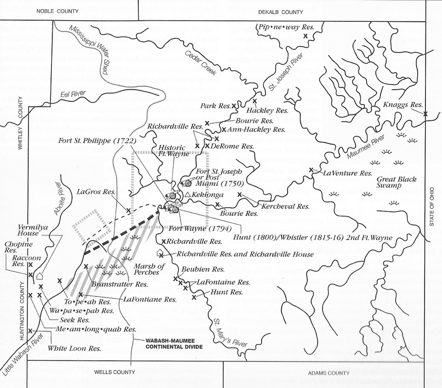
|
Kessler's Plan for Fort Wayne's Park System
Source: National Register of Historic Places Registration Form - Fort Wayne Parks and Boulevard System 
|
